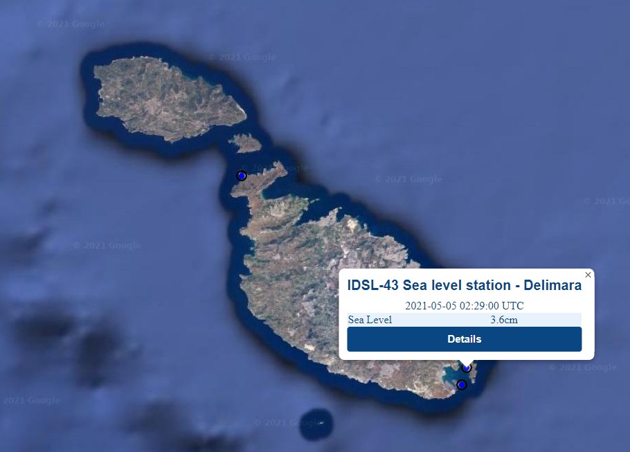
Sea level measured in cm
RED: Maximum in the last 24 hours
BLACK: Current value
BLUE: Minimum in the last 24 hours
Time (UTC)
Sea Level (cm)
No data available
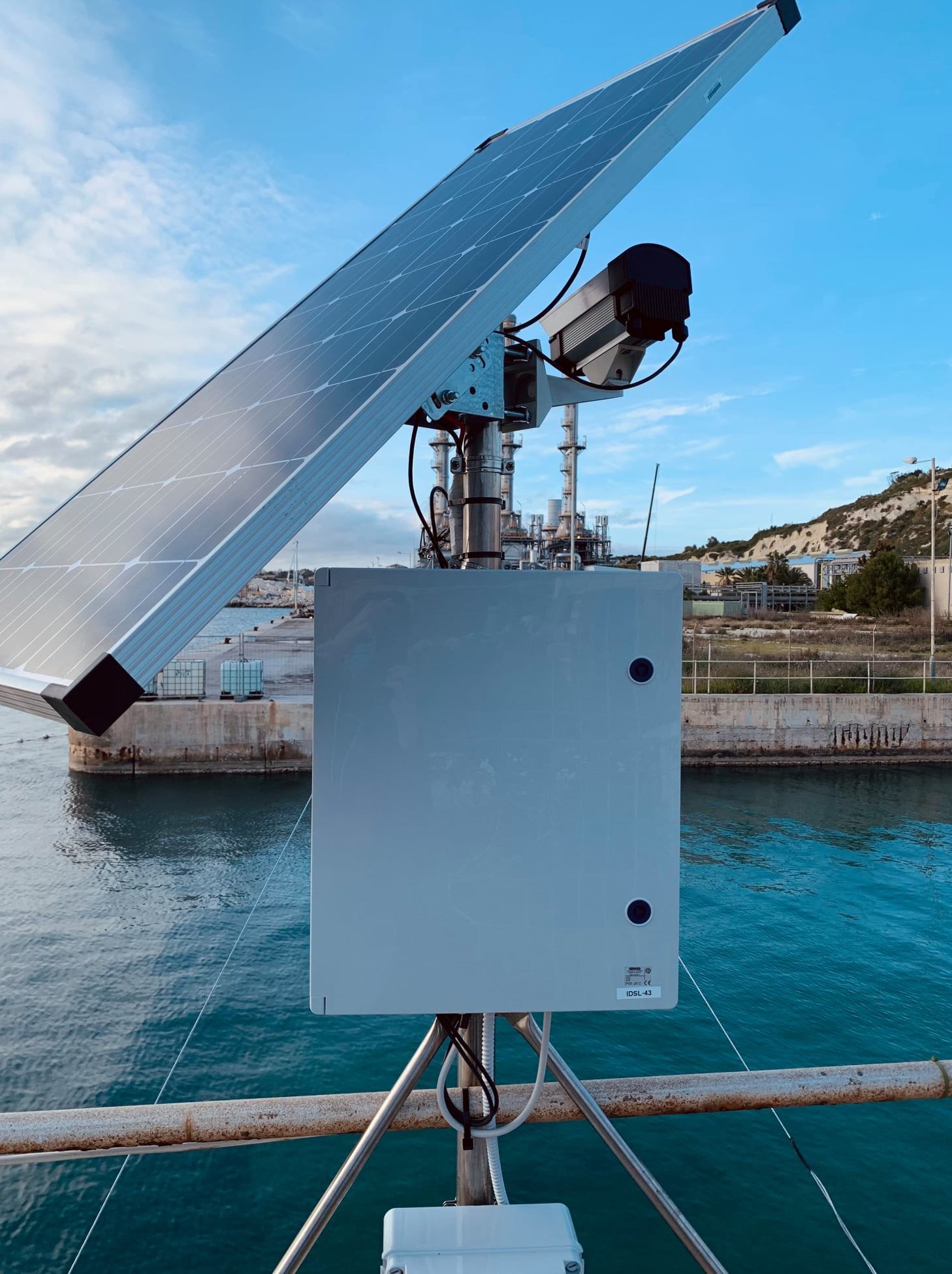
IDSL-43 sea level station in Delimara (Malta)
Figure 1: IDSL sea level station installed on the coast of Delimara.
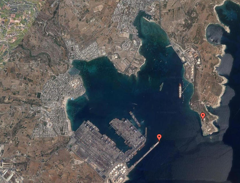
The PORTO network of meteo and sea level stations is made up a total of 15
stations in Malta and Sicily. One of the sea level stations in Malta is
situated within Marsaxlokk Bay on the coast of Delimara (Figure 1).
Figure 2 shows the exact location at 35.8316°N and 14.5547°E.
The sea level monitoring device installed at Delimara, known as an
Inexpensive Device for Sea Level Measurement (IDSL), has been designed by
the Joint Research Centre (JRC) of the European Commission (EC) in order
improve the sea level network in use for the Tsunami Hazard monitoring in
the Mediterranean Sea and in the North Atlantic area (NEAMTWS area of UNESCO).
The instrument has the characteristic of being cheap and very effective.
Its reliability, duration and quality were tested in a number of experimental
campaigns, whose first results are presented here. In collaboration with the
UNESCO/IOC (Intergovernmental Oceanographic Commission), responsible of the
definition of the Tsunami Warning System of this geographical area, a set of
20 devices has been offered by JRC for a period of 1 year of testing of the
devices; the surveys for the installation of the devices was completed in 2015.
The station registers the sea level at varying time intervals. The data is then
resampled to 5s intervals, and transmitted over HTTP (Hypertext Transfer Protocol)
to a central server at the University of Malta. Here the data is written to the
PORTO meteo and marine stations database as soon as it is received. Data from the
database is used to provide realtime data on the PORTO online interface (Figure 3).
The PO-Res Grp, led by Prof. Aldo Drago, is the lead partner in CALYPSO South.
The Group undertakes oceanographic research, in a holistic perspective, including
operational observations and forecasts, specialised data management analysis and
participation in international cooperative ventures. The overarching research
themes of the PO-Res.Grp cover coastal meteorology, hydrography and physical
oceanography with a main emphasis on the experimental study of the hydrodynamics
of the sea in the vicinity of the Maltese Islands. The Group has mainly endeavoured
to promote activities in operational oceanography by the installation and maintenance
of permanent sea monitoring systems, and the provision of meteo/marine forecasts.
In fact, the PO-Res Grp is responsible for management and custody of the data
collected by the whole PORTO network, as well as the development and maintenance
of the various interfaces that make this data available to stake holders and the
public in general.
Figure 2: The red marker to the right shows the position
of the sea level station close to the tip of the peninsula
at Delimara.
Figure 3: Realtime data from Delimara sea level
station as displayed on the PORTO online
interface.