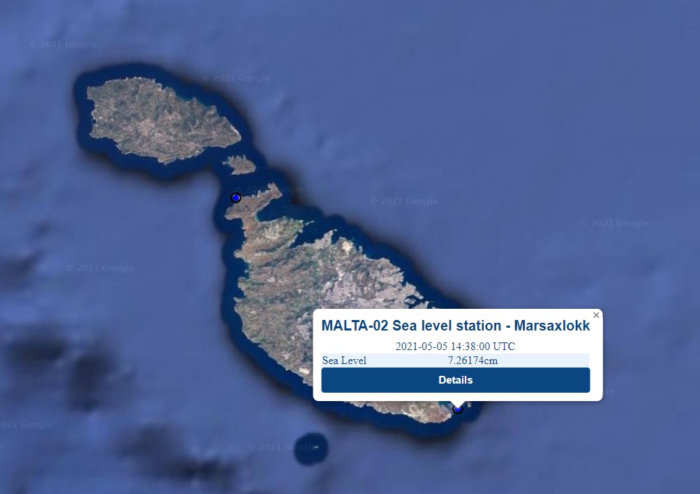
Sea level measured in cm
RED: Maximum in the last 24 hours
BLACK: Current value
BLUE: Minimum in the last 24 hours
Time (UTC)
Sea Level (cm)
No data available
MALTA-02 sea level station in Marsaxlokk (Malta)
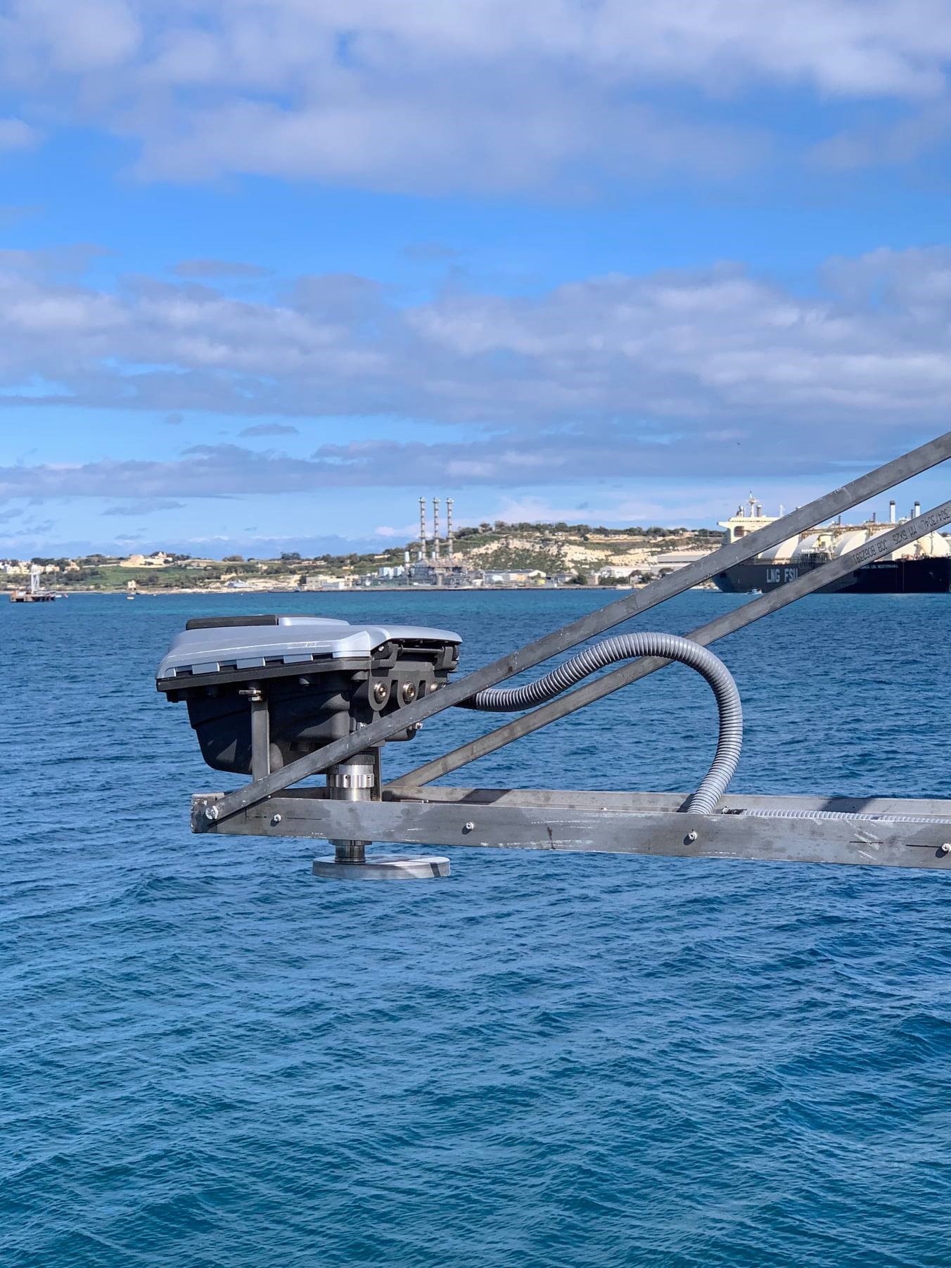
Figure 1: RADAC sea level station installed on the coast of Marsaxlokk.
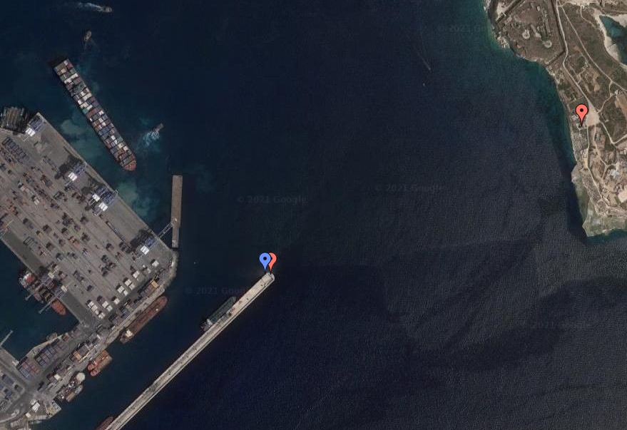
The PORTO network of meteo and sea level stations is made up a total of 15 stations
in Malta and Sicily. One of the sea level stations in Malta is situated within
Marsaxlokk Bay on the sheltered side of the breakwater outside the Freeport
Terminal (Figure 1). Figure 2 shows the exact location at 35.8181°N and 14.5494°E.
The sea level monitoring device installed at Marsaxlokk, is a RADAC WaveGuide 5
Height and Tide monitor. Mounted high above the water and without any moving parts
it does not need preventive maintenance or cleaning. Calibration is never required
due to long term stable zero reference and constant sensitivity. The system is
compact, robust and easy to install. It is equipped to measure wave heights and
tides accurately, even in the most extreme conditions. The station has been
included in the Tsunami Hazard monitoring in the Mediterranean Sea and in the
North Atlantic area (NEAMTWS area of UNESCO).
The station registers the instantaneous level of the sea surface from which it
then calculates the one-minute average height. This data is transmitted over
UDP (User Datagram Protocol) to a central server at the University of Malta.
Here the data is written to the PORTO meteo and marine stations database as
soon as it is received. Data from the database is used to provide realtime
data on the PORTO online interface (Figure 3).
The PO-Res Grp, led by Prof. Aldo Drago, is the lead partner in CALYPSO South.
The Group undertakes oceanographic research, in a holistic perspective,
including operational observations and forecasts, specialised data management
analysis and participation in international cooperative ventures. The overarching
research themes of the PO-Res.Grp cover coastal meteorology, hydrography and
physical oceanography with a main emphasis on the experimental study of the
hydrodynamics of the sea in the vicinity of the Maltese Islands. The Group has
mainly endeavoured to promote activities in operational oceanography by the
installation and maintenance of permanent sea monitoring systems, and the
provision of meteo/marine forecasts. In fact, the PO-Res Grp is responsible
for management and custody of the data collected by the whole PORTO network,
as well as the development and maintenance of the various interfaces that
make this data available to stake holders and the public in general.
Figure 2: The blue marker shows the position of the sea level
station on the breakwater outside Marsaxlokk Bay.
Figure 3: Realtime data from Marsaxlokk sea level
station as displayed on the PORTO online
interface.